| Title: | Eagles Rest |
| Area: | Willamette National Forest |
| Elevation: | 3022 Feet |
| Elevation_Gain: | 1422 |
| Trail: | Eagles Rest |
| Misc: | Eagles Rest is technically located on BLM land, but most of the trail to this peak is in the Willamette National Forest.
|
| Links: | Trip Journal - 10/30/06 |
| Notes: | Eagles Rest is a former fire lookout site. There are at least three hiking distance options for Eagles Rest, from a mere .7 miles to 14 miles. This suggested route is the middle distance of 2.5 miles. At the 1.5 mile point you will pass the Ash Swale Shelter.
|
| Trail_Number: | 3461 |
| Route: | From Eugene take Hyw 58 east to Lookout Point Reservoir, turn right on Goodman Creek Road # 5833 and proceed 3.1 miles, staying left at the first junction, to the trailhead for the Eagles Rest Trail, which is found on the right side of the road. |
| TH_elevation: | 1600 |
| Distance: | 2.5 |
| USGS_75: | Mt June |
| Reference: | 100 Hikes Central Oregon Cascades by Sullivan |
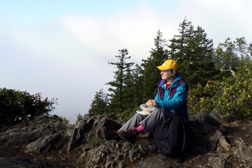
Janet Schalla - Eagles Rest - - - October 30, 2006 |
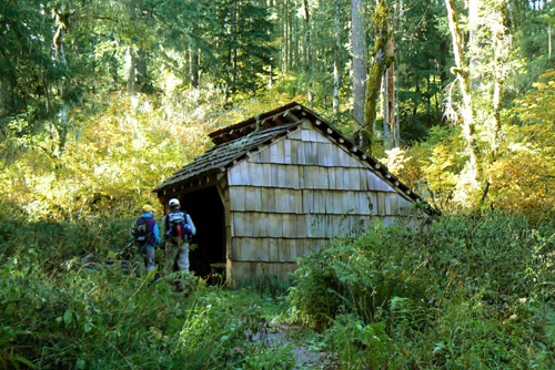
Ash Swale Shelter - - - October 30, 2006 |
| Type: | Peak |
| Day_Hike: | yes |