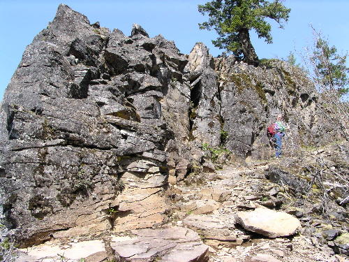
| Title: | Independence Rock |
| Area: | Willamette National Forest |
| Elevation: | 2870 Feet |
| Elevation_Gain: | 420 |
| Trail: | Independence Rock |
| Links: | Trip Journal - 4/24/04, TerraServer USA |
| Notes: | Independence Rock was named when John Minto's survey party rested in the area on Independence Day, July 4, 1874 while surveying the route of Minto Pass. |
| Trail_Number: | 3431 |
| Route: | From Salem, take Highway 22 east to Marion Forks. Turn left on the road to the Marion Lake Trailhead. Look for a trail sign on your left just 75 yards from the Highway |
| TH_elevation: | 2450 |
| Distance: | 1.0 |
| USGS_15: | Mt Jefferson |
| USGS_75: | Marion Forks |
| Reference: | 60 Hiking Trails Central Oregon Cascades by Lowe / Marion County Historical Society Vol XI / Day Hikes from Oregon Campgrounds by Ostertage |
Independence Rock - - - - - - - April 24, 2004 |
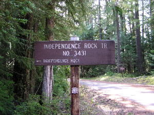
look for this sign to start your hike |
| Family_Outing: | yes |
| Day_Hike: | yes |