| Title: | Table Rock |
| Area: | Table Rock Wilderness |
| Elevation: | 4881 Feet |
| Elevation_Gain: | 1481 |
| Snow_Free: | Jun 19 |
| Misc: | fire lookout for Oregon State Foresty 1937 til 1940s |
| Links: | Trip Journal - 6/11/06 |
| Difficulty: | day hike |
| Notes: | The towering basaltic cliffs of Table Rock make it a virtual island in the Molalla River drainage. Although located close to Salem as the crow flys, you will need to allow 2 hours to drive to the trailhead. A landside blocks the road from the original trailhead, so the first 1.3 miles of the hike are on an abandoned road before hiking the remaining 2.3 trail miles to the top. |
| Route: | From the east end of Molalla follow signs to Feyer Park. From Feyer Park turn right on South Dickie Praire Road. Travel South Dickie Prairie to the bridge at Glen Avon. Cross the bridge and travel south 12 miles on South Molalla Road to the junction of Middle Fork and Copper Creek Roads. Cross the bridge. A left turn leads to the Table Rock Trailhead. |
| TH_Access: | May 06 |
| TH_elevation: | 3400 |
| Distance: | 4.6 |
| Features: | scenic, hiking |
| USGS_15: | Mill City |
| USGS_75: | Rooster Rock |
| Reference: | 50 Hiking Trails Portland & Northwest Oregon Lowe / Fire Lookouts of Oregon & Washington Kresek / Boot and Bikes / 100 Hikes in Northwest Oregon Sullivan |
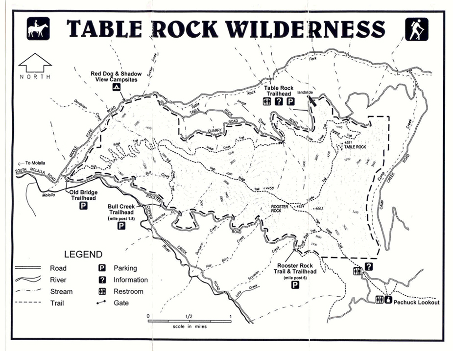
printable trail map |
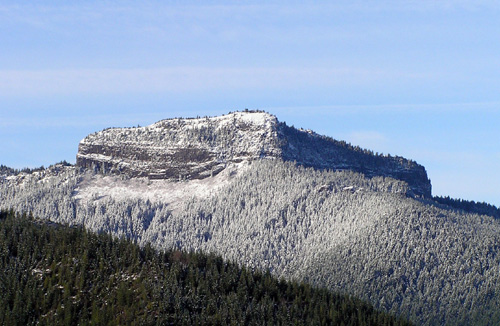
Table Rock from the east - - November 20, 2004 |
| Type: | Peak |
| Code: | mt |
| Day_Hike: | yes |
| Scenic: | yes |
| Wildflowers: | yes |