| Title: | Swordfern Trail | | Area: | Umpqua National Forest | | Elevation: | 1200 - 1450 Feet | | Trail: | Swordfern | | Misc: | A good map for this area is the Umpqua National Forest - Cottage Grove Ranger District Map. | | Links: |
Swordern Trail
Rujada Campground
Trip Journal - 7/13/09 | | Notes: | The The Swordfern Trail is located 21 miles southeast of Cottage Grove at the Rujada Campground along Laying Creek. The trail begins and ends in the day-use picnic area.
The listed milage for the Swordfern Trail of 2.1, is a loop milage. It can also be done in a shorter loop of 1.6 miles. If you want more hiking for the day continue on up Laying Creek Road to the Spirit Falls Trail, a short .4 mile trail leads to the falls. | | Trail_Number: | 1404 | | Route: | From Cottage Grove, take Row River Road, #2400, east 19 miles to the junction of Layng Creek Road, #17 and Brice Creek Road, #2470. Bear left on Road #17 and continue for 2 miles to Rujada Campground on the right. | | TH_elevation: | 1200 | | Distance: | 2.1 | | USGS_75: | Rose Hill | 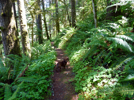
Swordfern Trail - - - - - - - July 13, 2009 | | Type: | Trail | | Camping: | yes | | Family_Outing: | yes | | Day_Hike: | yes | | Scenic: | yes |
|
|