Lakes,
Peaks
& Trails
Critters Trip Journal Wildflowers MushroomsBlog Contact


Date:  July 18, 2008

Location  Crabtree Lake Trail Hike

Where:  Linn County


 Yesterday Tyler Lebard and I had taken the 'longer road' access route to Crabtree Lake for fishing. I was left with a curiosity about the 'shorter road' access route and the hiking trail that the BLM map shows. This became the motivation for today's hike.

To get to this trailhead we drove up Quartzville Creek Road turning on BLM road - 35.1, and then on road ' 14.1. The road ends with an earth and rock barrier with two concert and rock pillars that I took to be a kind of trailhead entrance despite no signage.

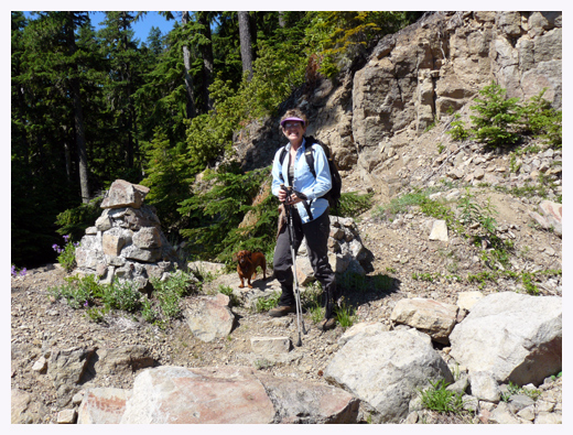
Buster and Jeanette at the trailhead

We began hiking on the old road, which has some great views of the Cascades, until we reached a saddle where I had hoped to find a direct trail down to the lake. After some steep scrambling around, we gave up and went back to the road. This road is evidently the route BLM considers the trail to the lake. In the early 70s I actually drove this road with my Datsun pickup and camper. At that time it was the main route from the Snow Peak area to Quartzville Creek and looking at my 1974 BLM map I see it was called the Yellowstone Access Road.

Mt Jefferson

On our hike back to the car, Buster found relief and diversion from the heat by digging in a snowdrift.

Buster digging in the snow