| Title: | Fairview Creek Trail |
| Area: | Umpqua National Forest |
| Elevation: | 1800 - 3000 Feet |
| Elevation_Gain: | 1200 |
| Trail: | Fairview Creek |
| Misc: | A good map for this area is the Umpqua National Forest - Cottage Grove Ranger District Map. |
| Links: |
Fairview Creek Trail
Mineral Camp Campground
Trip Journal - 7/1/10 |
| Notes: | Here is a little creek side trail that is mostly unknown and way underrated. Head here on a hot day and enjoy the deep shade of towering trees of spruce, fir, and cedar, and enjoy babbling Fairview Creek. It's just under three miles until the trail is lost, which makes a good turn around point. |
| Trail_Number: | 1408 |
| Route: | From Cottage Grove Exit 174 on Interstate 5, drive east on Row River Road, #2400, for 15 miles to Sharps Creek Road #2460. Proceed 10.2 miles from where Sharps Creek Road continues to the left and turns to gravel. Travel another 1.8 miles on gravel to the trailhead across from Mineral Camp. |
| TH_elevation: | 1800 |
| Distance: | 3.0 |
| USGS_75: | Fairview Peak |
Fairview Creek - - - - - - July 1, 2010 |

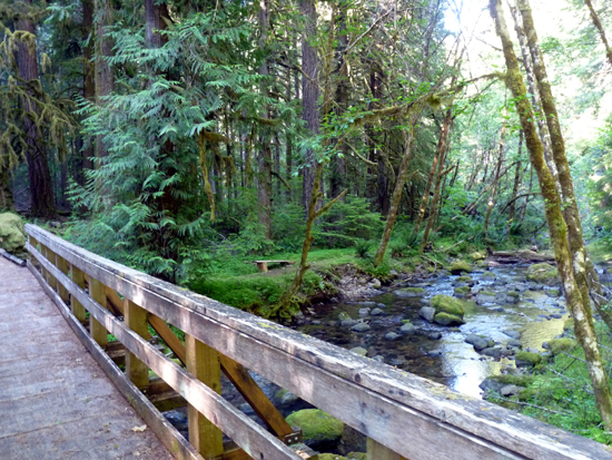
bridge crossing of Walton Creek |
| Type: | Trail |
| Family_Outing: | yes |
| Day_Hike: | yes |
| Scenic: | yes |
| Solitude: | yes |