| Title: | South Peak |
| Area: | Willamette National Forest |
| Elevation: | 5704 Feet |
| Elevation_Gain: | 1574 |
| Trail: | Cone Peak Trail and cross-country |
| Links: | Cone Peak Trail
Trip Journal |
| Notes: | There is no trail to the top of South Peak. For hikers with off-trail experience, my recommended route is to take the Cone Peak Trail, then traverse around the side of Cone Peak, hitting the ridge line between Cone & South, then taking the ridge line up to the summit of South Peak. |
| Trail_Number: | 3408 |
| Route: | From Sweet Home take Highway 20 east, 35 miles to Tombstone Pass. The Forst Service recomends parking in the Tombstone Pass Parking Lot. |
| TH_elevation: | 4130 |
| USGS_15: | Echo Mountain |
| USGS_75: | Echo Mountain |
| Reference: | Guide to the Middle and South Santiam Roadless Areas |
South Peak--June 20, 2002 |

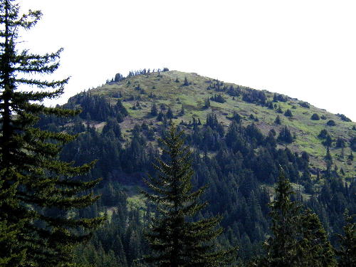
South Peak from the Cone Peak Trail - - June 20, 2002 |

South Peak- - October 15, 2002 |
| Type: | Peak |
| Experienced_Only: | yes |
| Day_Hike: | yes |