| Title: | Tombstone Lake |
| Area: | Eagle Cap Wilderness |
| Size: | 16 Acres |
| Depth: | 14 Feet |
| Elevation: | 7421 Feet |
| Elevation_Gain: | 1991 |
| Trail: | West Eagle & Tombstone Lake |
| Misc: | Note: There is no limit on the size and number of brook trout taken from these lakes. |
| Links: | Eagle Cap Wilderness, Trip Journal - 8/24/03 |
| Notes: | This is truly a fantastic destination, with lots of camping opportunities. It's well worth the effort to climb over the 8200 ft pass to get here. Don't overlook the small adjacent lakes for the best fishing. There are more brookies than you can possibly catch, clean and eat. Plan on staying a couple of days, you won't regret it. |
| Trail_Number: | 1934 & 1943 |
| Route: | From La Grande, take I-84 south to exit 265 and travel east on Highway 203 14 miles to Union. In the center of town, turn left of Beakman Street and continue past Catherine Creek State Park to the summit, turning on Road 77 to West Eagle Meadows. The last 5 miles are rough and rocky. A Northwest Forest Pass is required to park here. |
| TH_elevation: | 5430 |
| Distance: | 8.4 |
| USGS_75: | Steamboat Lake |
| Reference: | Backpacking Oregon by Lorain / Hiking Oregon's Eagle Cap Wilderness |
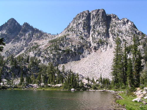
Tombstone Lake - - - - - August 25, 2003 |

looking down on Tombstone Lake from the pass - - - August 26, 2003 |
| Type: | Lake |
| Backpack: | yes |
| Fishing: | yes |
| Scenic: | yes |
| Swimming: | yes |
| Wildflowers: | yes |