| Title: | Traverse Lake |
| Area: | Eagle Cap Wilderness |
| Size: | 19 Acres |
| Depth: | 31 Feet |
| Elevation: | 7720 Feet |
| Elevation_Gain: | 2290 |
| Trail: | West EagleTrail |
| Misc: | Note: There is no limit on the size and number of brook trout taken from these lakes |
| Links: | Trip Journal - 8/21/03 |
| Difficulty: | backpack |
| Notes: | Traverse Lake is located in a beautiful setting, but is some what marred by the fact that water is drained off for irrigation leaving a beach-line around the lake edge |
| Trail_Number: | 1934 |
| Route: | From La Grande, take I-84 south to exit 265 and travel east on Highway 203 14 miles to Union. In the center of town, turn left of Beakman Street and continue past Catherine Creek State Park to the summit, turning on Road 77 to West Eagle Meadows. The last 5 miles are rough and rocky. A Northwest Forest Pass is required to park here. |
| TH_elevation: | 5430 |
| Distance: | 6.6 |
| USGS_75: | Bennet Peak |
| Reference: | 100 Hikes Eastern Oregon by Sullivan / Hiking Oregon's Eagle Cap Wilderness Barstad / Backpacking Oregon by Lorain |
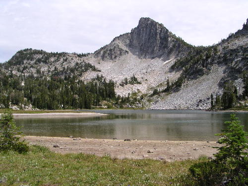
Traverse Lake - - - - - August 21, 2003 |
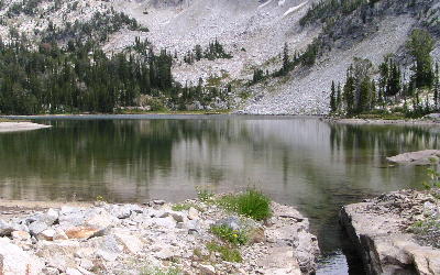
channel cut in rock for irrigation |
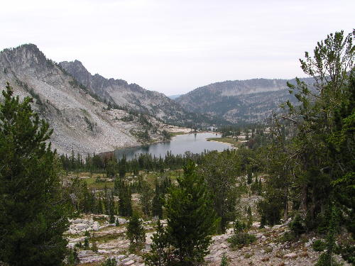
looking down at Traverse Lake from the trail above |
| Type: | Lake |
| Backpack: | yes |
| Fishing: | yes |
| Scenic: | yes |