| Title: | Catherine Creek |
| Area: | Columbia River Gorge National Scenic Area |
| Elevation: | 260 Feet |
| Links: |
Columbia Gorge National Scenic Area
Friends of the Columbia River Gorge
Trip Journal - 4/21-22/01 |
| Notes: | Catherine Creek drains into the Columbia River on the Washington side between the towns of Bingen and Lyle. The National Forest owns some 3-4 thousand acres here, which means there is lots of public access for hiking.
On the south side of County Road 1230 is the Catherine Creek Universal Access Trail. The paved trail takes you through wooded oak groves and flowering meadows overlooking the Columbia Gorge. Although very scenic it is rather short.
On the north side of County Road 1230 lies the larger area, with grassy hillsides, steep canyons and rocky outcropings. It's a vast area and provides an opportunity to get out and really stretch your legs. Although, no official trails are here, there are many paths to direct your hiking efforts. |
| Route: | from Bingen, Washington...Follow SR-14 approximately 4.6 miles to mile post 71 and junction with County Road 1230 on the left. Turn left onto County Road 1230 at Rowland Lake and follow it 1.4 miles to the Catherine Creek parking lot on the north side of the road. |
| USGS_75: | Lyle |
| Reference: | Wildflowers of the Columbia Gorge by Russ Jolley / 100 Hikes in Northwest Oregon by William Sullivan |
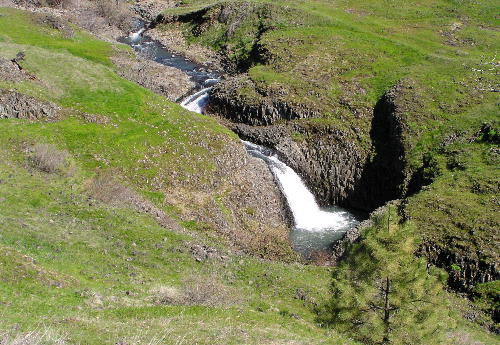
Catherine Creek from the Universal Trail - - March 16, 2004 |
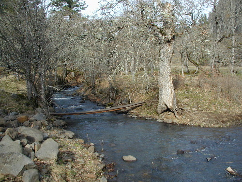
footbridge accross Catherine Creek February 12, 2002 |
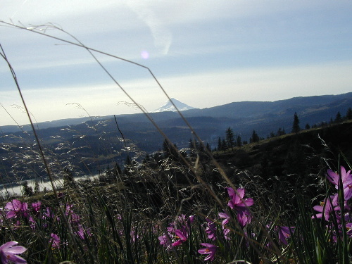
Mt Hood from a field of Grass Widows February 12, 2002 |
| Backpack: | yes |
| Car_Trip: | yes |
| Family_Outing: | yes |
| Day_Hike: | yes |
| Wildflowers: | yes |