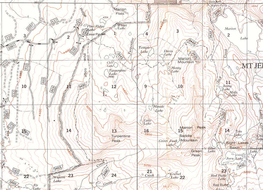
| Title: | Turpentine Lake |
| Area: | Mt Jefferson Wilderness |
| Size: | 8 Acres |
| Depth: | 29 Feet |
| Elevation: | 4690 Feet |
| Elevation_Gain: | 150 |
| Snow_Free: | Jun 12 |
| Camp_Sites: | 3 |
| Trail: | Pine Ridge Trail & cross country |
| Misc: | Stocked annually with brook trout, rainbow trout, or cutthrout trout. |
| Links: | Trip Journal - 6/20/2004 |
| Notes: | The easiest way to get to Turpentine Lake is to take the Pine Ridge Trail to the first stream, turn right upstream following the path to an unnamed lake, look closely for a path continuing on up to Turpentine. A GPS could be a real help here. Turpinte Lake itself is deeper than most of the surrounding lakes, so does not suffer from winter-kill. |
| Trail_Number: | 3443 |
| Route: | From Salem take Highway 22 east to Twin Meadows Road #2261 @ MP 70, then 5 miles to trailhead parking on gated road #536, just beyond Camp Pioneer |
| TH_Access: | Jun 07 |
| TH_elevation: | 4540 |
| Alt_trail: | #3490 Turpentine Trail & cross country |
| Distance: | 1.5 |
| Features: | fishing |
| USGS_15: | Mt Jefferson |
| USGS_75: | Marion Forks |
| Reference: | Mt Jefferson Wilderness Guidebook by George |
Printable Map |
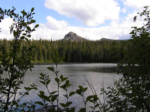
Turpentine Peak from Turpentine Lake - - - June 20, 2004 |
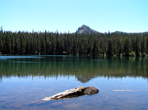
Turpentine Lake - - - July 27, 2006 photo by Todd Whithead |
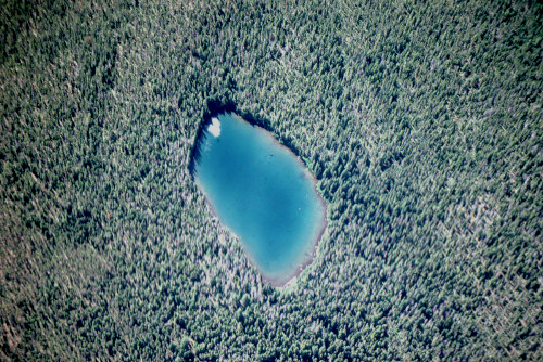
Turpentine Lake from the air - - - September 1975 - - - courtesy ODFW |
| Type: | Lake |
| Backpack: | yes |
| Experienced_Only: | yes |
| Fishing: | yes |