| Date: November 3, 1999 | | Location Canada to Mexico - #46 - San Diego to the Border | | Where: Border Field State Park | Wednesday - Jim writes
A Borderline Experience
Today we officially finished our border-to-border ride by cycling to the Mexican border. As you might expect, we have an experience to relate.
This morning we caught a ferry to Coronado from the dock near our hotel. Then we cycled along the bike path past the golf course, the Coronado Yacht Club and south past the Silver Strand State Park - several miles to Imperial
Beach.
Starting at the town of Imperial Beach we began to feel that we were getting close to Mexico. Gone was the elegance of San Diego, its greenery replaced by drab homes and streets in poor repair. We cycled south away from town and crossed the Tijuana River, or where it would be if there was any water. By the time we got to Border Field State Park, our destination, the road had deteriorated to dirt. Arriving at the park entrance we found a locked gate, with a sign saying, "Open Thurs-Sun". Here we were on Wednesday! We took some pictures of ourselves with the sign and the locked gate. Then we watched as several vehicles drove around the gate through the brush and into the park. As a border patrolman drove out we stopped him and asked, "Is it all right for us to go in?" He explained that he had no control over the park, that the park is state and he is federal. In other words he didn't say yes and he didn't say no. He did tell us where we could take some pictures of the border.
We decided to go into the park. The "dirt" road was so soft with sand we couldn't ride our bikes so had to push them along. As we entered we passed workers who were putting in a ditch but we do not "see" them and they did not seem to notice us. We choose a road with a picnic sign.
A little further we could see the actual boarder, a metal fence 15 feet high, running east and west. Border Patrol vehicles were perched on several vantage points in the distance. On the U.S. side is a dusty wasteland. The Mexican side is a fashionable hillside community with houses and paved roads. Jeanette was fascinated with the fence and drug her bike over the sand until she was near it. She tried to get me to come nearer but I was reluctant. With the zoom lens I took a photo with her hand on the fence. She was satisfied and we were ready to leave when suddenly a border patrolman appeared in his 4x4 Ford Bronco. He rolled down his window and from behind shaded glasses says that they get a little nervous when people are too close to the fence. He has come to check things out. Jeanette, unflappable as usual finds him quite attractive, blond crew cut, suntan, uniform, sunglasses, bulging biceps and all. She asked question after question. We finally find out that there is a nice park for lunch on top of the hill, so we drag our bikes on.
The picnic area is atop a small mesa with a paved road winding to the top. Arriving at the top we were quite surprised to find a lovely park, beautiful mowed lawns, picnic tables and restrooms. We had the place to ourselves except for the ever-present border patrol.
The border here is marked with a chain link fence. Through it you can see a small Mexican beach town with a lighthouse and an imposing structure we finally recognize as a bullring. The map confirms that it is indeed, named "Bullring-by-the-Sea".
After lunch we retraced our steps and cycled back to U.S. civilization.
With sadness, we boxed up our bikes at the AMTRAK station in preparation for our boarding at 6:00 AM tomorrow morning.
| 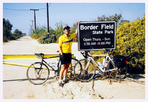 | | Jeanette at the locked gate | 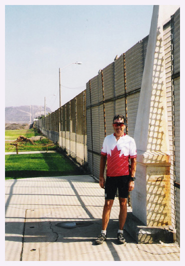 | | Jim at the border monument Days Distance: 37.0
Days Climb: 190 feet
Days Average Speed: 10.4 mph
Days Max Speed: 19.5 mph
Total Distance: 1996.2 miles | 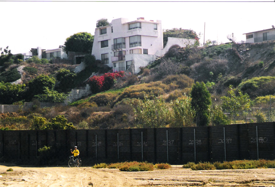 | | Jeanette at the border fence |  | | the border into the ocean |
|
|