| Title: | Eagle Rock Nature Trail | | Area: | San Luis Obispo County | | Elevation: | 380 - 800 Feet | | Elevation_Gain: | 420 | | Trail: | Eagle Rock Nature Trail | | Links: |
El Chorro Regional Park
Trip Journal - 12/3/10, 2/14/12 | | Notes: | The Eagle Rock Nature Trail is located in the extensive El Chorro Regional Park which features a golf course, campground, ballpark, picnic areas, botanical garden, and dog park. This self-guided trail climbs up through a canopy of Coastal Live Oaks before breaking out into the open and out to a rock formation called Eagle Rock. From this viewpoint you get a great view of the surrounding area including clear to the ocean with Morro Rock. Although a short hike to the rock of less than a mile, it can be combined with returning on the Oak Woodland Trail for a total loop of about 2.5 miles. | | Route: | From San Luis Obispo take Highway 1 North about 4 miles, turn right into El Chorro Regional Park, stay to the right and drive through the Day-Use-Area to the end of the road. Park on the left and walk up the road 0.1 mile to the trail on the right. | | TH_elevation: | 380 | | Distance: | 0.7 | | USGS_75: | San Luis Obispo | | Reference: | San Luis Obispo County Trail Guide | 
| 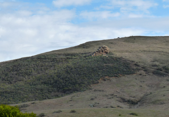
Eagle Rock | 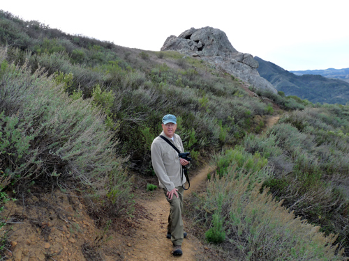
Eagle Rock Nature Trail - - - - December 3, 2010 | | Type: | Trail | | Camping: | yes | | Family_Outing: | yes | | Day_Hike: | yes | | Mountain_Biking: | yes |
|
|