| Title: | Deschutes River Trail | | Area: | Sherman County | | Elevation: | 190 - 390 Feet | | Elevation_Gain: | 200 | | Links: |
Deschutes River Recreation Area
Trip Journal - 4/14-15/01, 3/12/04 | | Notes: | The main trail here is an old abandoned railroad bed, extending some 17 miles up the river and used by mountain bikers, hikers, and equestrians. Running right next to the river is the Atiyeh Deschutes River Trail(shown in the above photo), used by fishermen, and hikers, which can be taken alongside the river for over 3.5 miles to Gordon Canyon. In between these two trails is a third trail, the Middle Trail, used by hikers, and when combined with the Ferry Springs section provides a nice 4.5 miles loop. | | Route: | From The Dalles drive 17 miles east on I-84, take Exit 97 | | TH_elevation: | 190 | | Alt_trail: | Atiyeh River Trail, Middle Trail, Ferry Springs Trail | | Distance: | 17 | | USGS_75: | Wishram | | Reference: | 100 Hikes in Northwest Oregon by Sullivan | 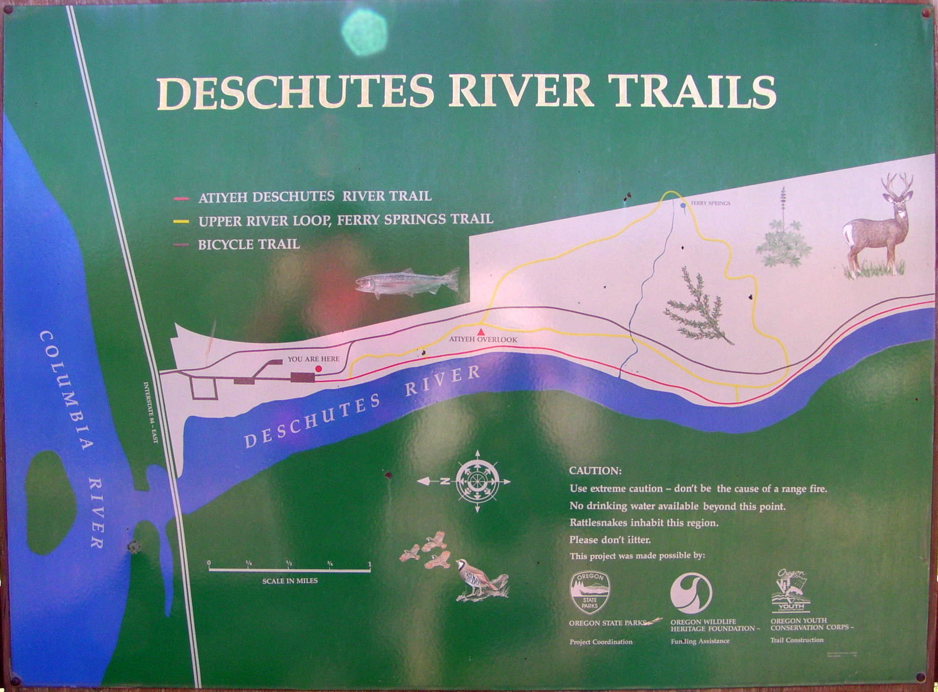
Trail Map | 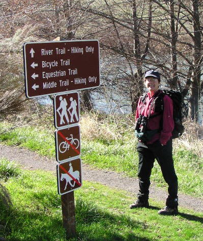
Deschutes River Trail - - - - - - March 12, 2004 | | Type: | Trail | | Backpack: | yes | | Camping: | yes | | Car_Trip: | yes | | Family_Outing: | yes | | Fishing: | yes | | Day_Hike: | yes | | Historic: | yes | | Mountain_Biking: | yes | | Scenic: | yes |
|
|