| Title: | McNeil Point |
| Area: | Mt Hood Wilderness |
| Elevation: | 6000 Feet |
| Elevation_Gain: | 2080 |
| Trail: | Top Spur Trail & Timberline Trail |
| Misc: | Named for Fred H. McNeil, Portland newspaper man and outdoor enthusiast. |
| Links: | Trip Journal - 9/28/2002 |
| Difficulty: | experienced only |
| Notes: | McNeil Point sits perched on the Northwest flank on Mt Hood between the Sandy Glacier to the south and the Glisan Glacier on the north. From this viewpoint you can easily recognize Mt Rainer as well as St Helens, and Mt Adams. A stone shelter, built by the CCC in the 1930s gives charm to the site, but don't count on being able to use it for shelter as the area has a very high level of use. |
| Trail_Number: | 785 & 600 |
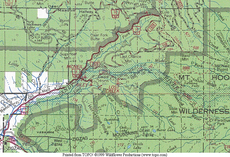
| Route: | From Zigzag take Lolo Pass Road for 4.2 miles, turning right onto Road 1825 and then straight on Road 1828 for 7 miles to a pullout at Top Spur Trailhead. |
| TH_elevation: | 3920 |
| Distance: | 4.5 |
| USGS_75: | Mt Hood North |
| Reference: | 100 Hikes in Northwest Oregon by Sullivan / Oregon Geographic Names by McArthur |
|
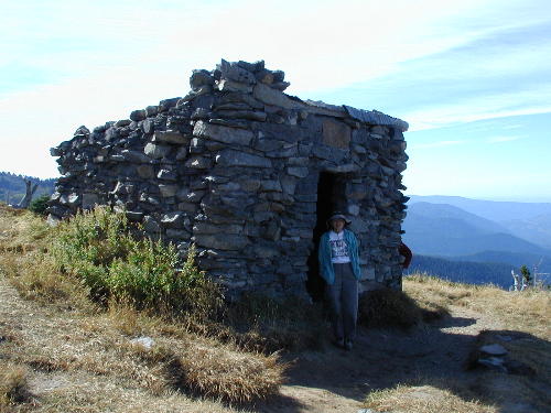
stone shelter at McNeil Point |
| Type: | Peak |
| Experienced_Only: | yes |
| Day_Hike: | yes |
| Scenic: | yes |