| Title: | Battle Ax |
| Area: | Bull of the Woods Wilderness |
| Elevation: | 5558 Feet |
| Elevation_Gain: | 1758 |
| Trail: | Battle Ax Trail |
| Links: | Battle Ax Mountain Trail
Trip Journal - 8/25/02 , 11/13/03 |
| Notes: | The view from the top of Battle Ax more than makes up for the bad road you have to travel to get within hiking distance. The official trail to the top of Battle Ax actually starts at Beachie Saddle, but because the road to Beachie Saddle is washed out and overgrown you must begin hiking before. My recomedation is to drive to Elk Lake, cross Elk Lake Creek and park at a large cut-out on the right side before you reach the fork to the left to Elk Lake Campground. The milage and trailhead elevation listed here are based on parking at this cut-out |
| Trail_Number: | 3340 |
| Route: | From Detroit, drive 4 miles up Breitenbush Road, turning left on 4696, and left again on 4697 to Elk Lake. Road 4697 is not maintained and is in very poor condition. |
| TH_elevation: | 3800 |
| Distance: | 2.5 |
| USGS_15: | Battle Ax |
| USGS_75: | Battle Ax |
| Reference: | Oregon's Hidden Wilderness / 100 Hikes Central Oregon Cascades |

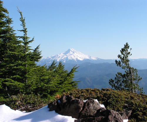
Mt Jefferson from Battle Ax summit - Nov 13, 2003 |
| Type: | Peak |
| Day_Hike: | yes |
| Scenic: | yes |

