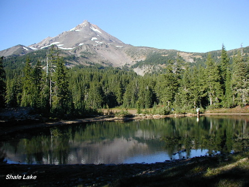
| Title: | Shale Lake |
| Area: | Mt Jefferson Wilderness |
| Size: | 1 Acre |
| Depth: | 14 Feet |
| Elevation: | 5900 Feet |
| Elevation_Gain: | 1460 |
| Snow_Free: | Jul 22 |
| Camp_Sites: | 10 |
| Trail: | Woodpecker Ridge Trail & #2000 Pacific Crest Trail |
| Misc: | This lake is not stocked |
| Links: | Trip Journal - 9/26/2000 |
| Difficulty: | backpack |
| Notes: | This is a beautiful alpine area with lots of opportunity for camping sites and great views of Mt Jefferson. Note: If approaching via Pamelia Lake Trailhead between Memorial Day and October 31, you must obtain a Limited Entry Permit from the Detroit Ranger District. |
| Trail_Number: | 3442 |
| Route: | From Salem take Hwy 22 to Woodpecker Rd #040 @ MP 61to Woodpecker Ridge Trailhead |
| TH_Access: | Jun 04 |
| TH_elevation: | 4440 |
| Alt_trail: | #3439 Pamelia Lk Tr/ left #3440/ right #2000 7.7 mi 2800'gain |
| Distance: | 7.5 |
| Features: | scenic, camping |
| USGS_15: | Mt Jefferson |
| USGS_75: | Mt Jefferson |
| Reference: | Mt Jefferson Wilderness Guidebook by George |
September 26, 2000 |
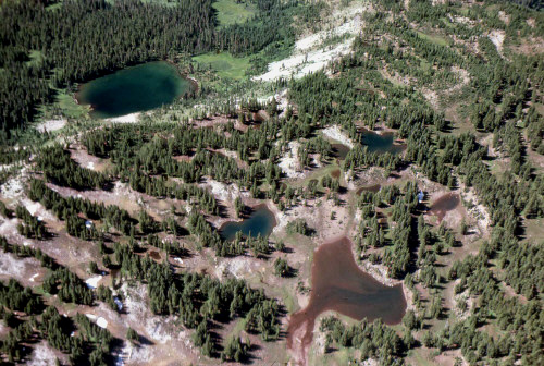
Shale Lake (second from left) - - - September 1975 - - - courtesy ODFW |
| Type: | Lake |
| Backpack: | yes |
| Scenic: | yes |