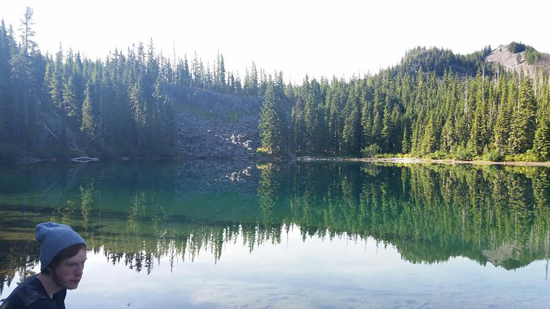
| Title: | Gifford Lake |
| Area: | Olallie Scenic Area |
| Size: | 8 Acres |
| Depth: | 50 Feet |
| Elevation: | 4950 Feet |
| Elevation_Gain: | 150 |
| Snow_Free: | Jun 23 |
| Camp_Sites: | 2 |
| Trail: | Fish Lake Trail (0.4 XC) |
| Misc: | refered to as Middle Lake in Lakes of Oregon vol. 5, prepared by US Dept Interior Geological Survey of 1977 |
| Notes: | This lake was probably originally meant to be known as Middle Lake, and it makes the most sense when you consider its position in reference to Upper and Lower Lakes. However due to confusion over maps or use, it is known as Gifford. The original Gifford is what is now know as Lower Gifford. |
| Trail_Number: | 717 |
| Route: | Breitenbush Rd #46 to Skyline Rd #4220 to Lower Lake Camp Ground |
| TH_Access: | Jun 15 |
| TH_elevation: | 4770 |
| Distance: | 1 |
| Features: | fishing |
| USGS_15: | Breitenbush |
| USGS_75: | Olallie Butte |
| Reference: | Lakes of Oregon vol 5 / Olallie Scenic Area Guidebook by George / Exploring Oregon's Wild Areas by Sullivan |

photo by Anthony Journey - - - July 2015 |
| Type: | Lake |
| Experienced_Only: | yes |
| Fishing: | yes |

