| Title: | Bradley Lake |
| Area: | Willamette National Forest |
| Size: | 4 Acres |
| Depth: | 13 Feet |
| Elevation: | 3830 Feet |
| Elevation_Gain: | 400 |
| Snow_Free: | May 14 |
| Trail: | hike x/c from Rd 2267 |
| Misc: | ODFW biologist Joe Wetherbee has given this lake the name of Bradley for his son Bradley. Normally stocked annually with brook trout and, or rainbow trout. |
| Links: | Trip Journals - 2/12/94, 4/29/04, 1/23/06 |
| Notes: | This lake, not named on any maps is located on the north edge of section 33, which for many years belonged to the Timber Service Company Inc. It is now a part of the Willamette National Forest. Close by is Chris Lake to the south-east. Clear-cutting around these lakes makes the area a great cross-country ski area in the winter.
I can't say that I would recomend this lake for fishing, based on the trips I have made there, inspite of the fact it is stocked annually. |
| Route: | From Detroit continue on Highway 22, turning left on Big Meadows Rd #2267 |
| TH_Access: | May 01 |
| TH_elevation: | 3430 |
| Alt_trail: | Hike in from gate on Rd 202 approx 1.5 miles |
| Distance: | 0.5 |
| USGS_15: | Three Fingered Jack |
| USGS_75: | Santiam Junction |

The shortest way to Bradley Lake is to hike south through the timber from Rd 2267 |
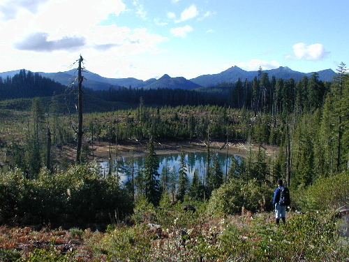
Looking down on Bradley Lake with The Three Pyramids in the background 11/17/01 |
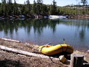
April 29, 2004 |
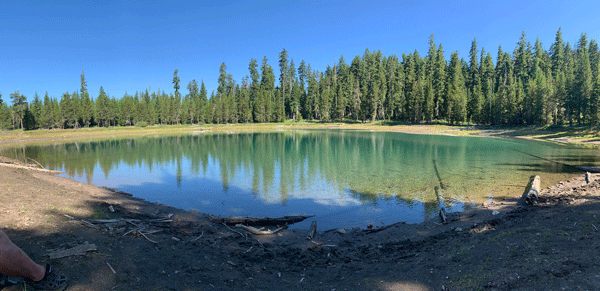
photo by Erik Badzinski - July 26, 2020 |
| Type: | Lake |
| Cross_Country_Skiing: | yes |
| Day_Hike: | yes |
| Mountain_Biking: | yes |